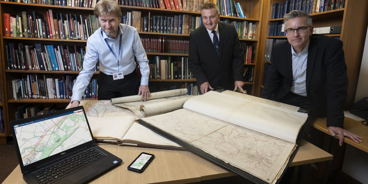
A map which depicts thousands of miles of public rights of way which residents and visitors can make use of has reached its 70th birthday.
Durham County Council’s Definitive Map was created in November 1952. It is a legal record indicating the position and status of Public Rights of Way (PROW) across County Durham.
In 1949 the National Parks and Access to the Countryside Act 1949 gave all county councils in England and Wales the duty of surveying and mapping all public rights of way in their area. The authorities needed to classify them as footpaths, bridleways or roads used as public paths.
The map started off as a paper map, which was housed in County Hall, and members of the public could come in and check the existence and status of a right of way. Since 2010 it has been accessible in a digital format on the council’s website.
Where the map shows a public right of way, the map is conclusive evidence that there was, at the relevant date, a highway as shown.
Cllr John Shuttleworth, the council’s Cabinet member for rural communities and highways, said: “The Definitive Map has been a brilliant resource for the county since it was created 70 years ago. Thanks to modern technology our staff are able to continually update the map, meaning that members of the public can explore as much of our beautiful and historic county as possible.
“I’d encourage anyone looking to get out and experience more of the county’s landscape to have a look at the map and find out more.”
The council’s access and rights of way team looks after 2,200 miles of public rights of way across County Durham including footpaths, bridleways, restricted byways and byways.
The team is responsible for recording and maintaining the map, a legal record, by dealing with applications to move paths, close paths, or add new paths.
This includes applications to add historic bridle paths, each of which needs archive research of old documents.
The team is also responsible for maintenance – making sure paths are able to be used by the public, and enforcement – taking action where necessary against anyone who obstructs a public right of way.
Those who are looking to explore their area, but are unsure which paths have public rights and who is allowed to use them, can check using the Definitive Map. To check exactly where you have the legal right to go, visit www.durham.gov.uk/definitivemap
More details on public rights of way in County Durham are available at www.durham.gov.uk/prow


